The centerpiece of our trip was the Gibb River Road (GRR). It is a 660km dirt (aka "unsealed") road, and was the main reason we had a 4WD vehicle. The main sights along the way are a series of "pictures-can't-do-us-justice" gorges.
Everything we read about the Gibb made it sound a bit daunting, since we'd never driven on dirt roads for this long before, and never forded crocodile-infested rivers. But we made it... far more easily than we'd expected.
Here's what we saw at the beginning of the road (although the first 25kms or so were recently paved...):

El Questro
Our first stop was within El Questro (a major tourist company that owns a massive piece of land, which happens to have some gorgeous sights).
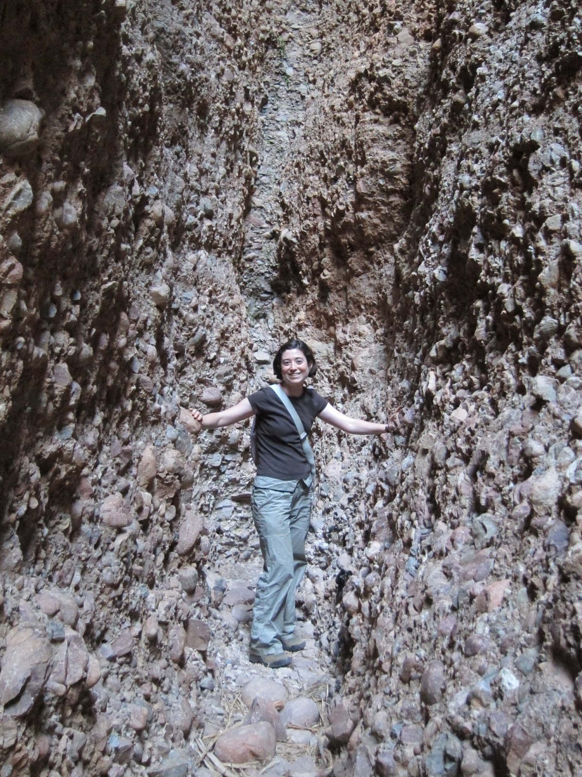
Our first gorge was at Emma Gorge. This involved a walk along a very rocky path beside a burbling creek, surrounded by some surprisingly lush vegetation.

This was a pretty-coloured pool we arrived at just before getting to the main part of the gorge. It was too big to photograph properly, but you can at least get a sense of the pretty colours:

The next stop, also within El Questro, also felt like an oasis. This was Zebedee Springs: a group of thermal springs surrounded by the rare Livitsonia Palms (which you may recognize from the Bungle Bungles).

The view looking up:

Pentecost River to Ellenbrae
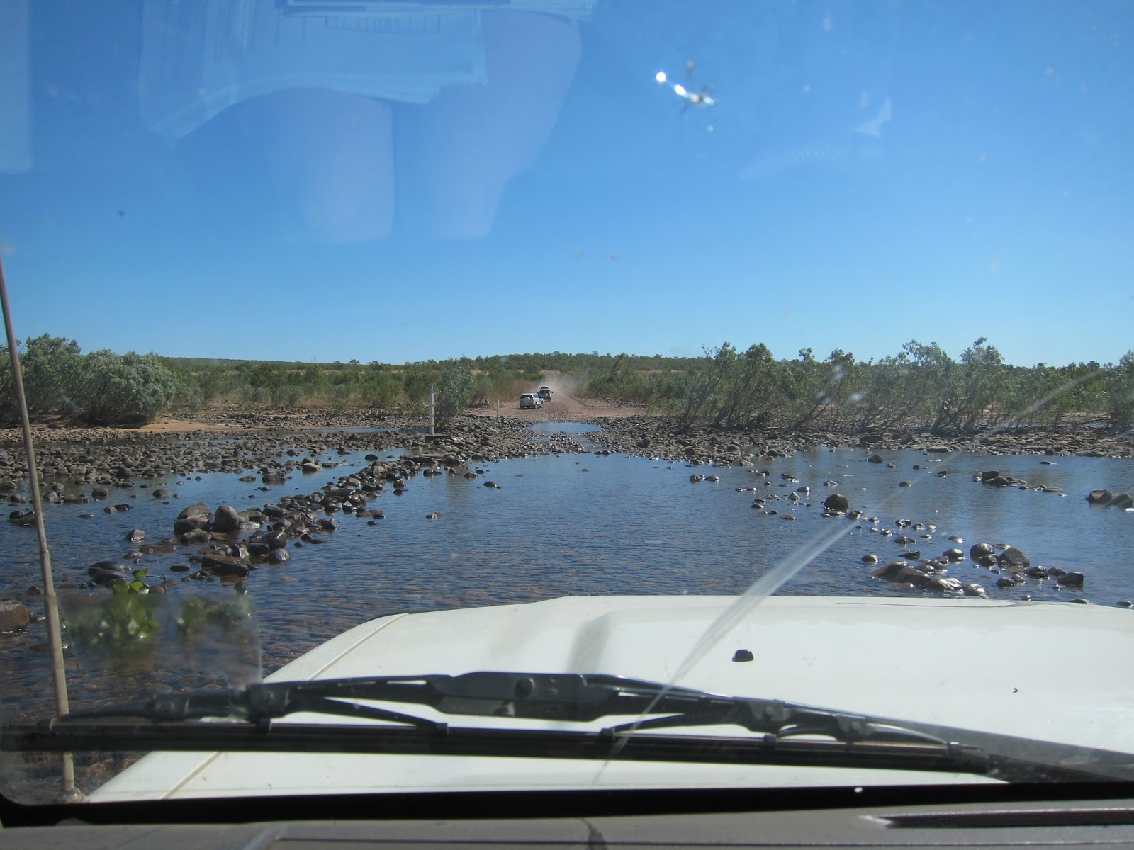
We continued on the road, when we came upon our first (and biggest) river crossing: the Pentecost River. We'd been warned about crocs there, so we didn't linger. Since this was the dry season, the water was pretty low... and we didn't see any crocs.
Here's a view along the road just after the Pentecost River.

This was our first encounter with non-bird wildlife. Don't worry: this is a picture we took from the car, and we had no other personal encounters with snakes for the rest of the trip:

Our goal for our first night was to get to one of the places along the road where we could camp: a station (i.e. a ranch) called Ellenbrae. Along the driveway into the property were some very nice hand-painted signs that kept our spirits up in the heat:

We made it in time to enjoy our scones in their beautiful gardens:

The station was originally owned and built up (including the gardens and buildings) by a pair of brothers. A plaque said both died a few years apart, one in a plane crash and the other in a motorcycle accident. Their creative handiwork was still evident around the property, including this stone table with tractor-seat chairs:

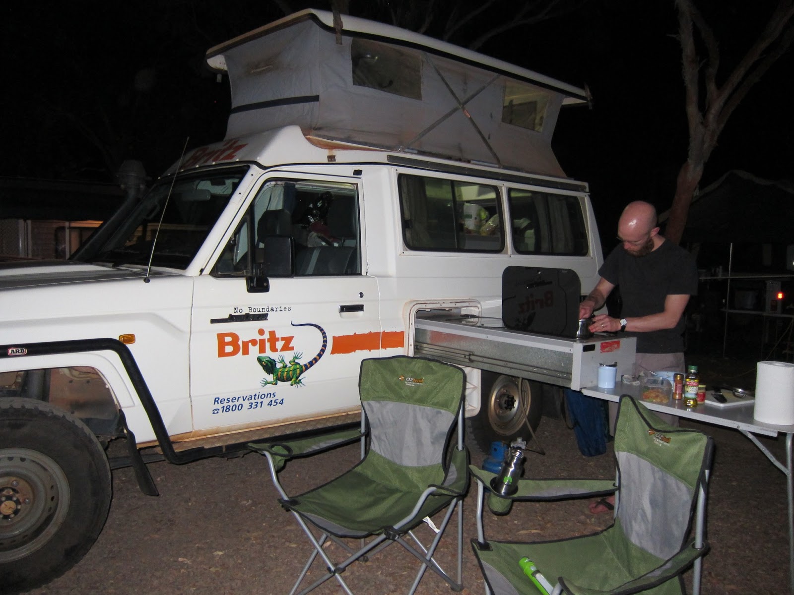
That night we ate dinner by a fire. The fire was surprisingly easy to get going - pretty much everything lying around was happy to burst into flame (more about that later). This finally felt like the "real" outback.

Ellenbrae to the Mornington Turn-Off
Continuing along the road the next morning, we came across a flock of gulahs headed in the same direction:

Our mid-day goal was Barnett River Gorge. The directions we'd found online said that it was a 3k drive off the main road, and that we should allow 30 min each way for the drive. "Silly directions," we thought, "it doesn't take 30 minutes to drive 3 kilometers."
Turns out it can. The road was filled with spikey rocks just waiting for a tire to puncture. This picture only gives a vague idea...


Our destination for that night was a campground by the Mt. Barnett Roadhouse, by Manning Gorge. Our camping spot was next to some clusters of boabs:

The next morning, we walked to Manning Gorge. The trail wasn't long, but required one to pull oneself across by hand. Here's Colin, after our crossing, feeling proud of himself for not having dumped us in the water:

Manning Gorge itself was stunning and, like all the gorges, defied any attempts to capture it by photos. Here's one of the photos it defied (see the waterfall in the distance?):

On the road after Manning Gorge, we drove by some surprisingly large birds co-habitating peacefully with the very large cows:

Mornington Wildlife Sanctuary
Our destination for that night was the Mornington Wildlife Sanctuary, which lies 90k off the Gibb. The Sanctuary is funded by the Australian Wildlife Conservancy. Being a considerate group, they set up a booth at the turn-off where one can radio ahead. This avoids one driving an extra 90k only to find that there are no campsites left. We were lucky - we snagged one of the last two spots. Here's the call-box:

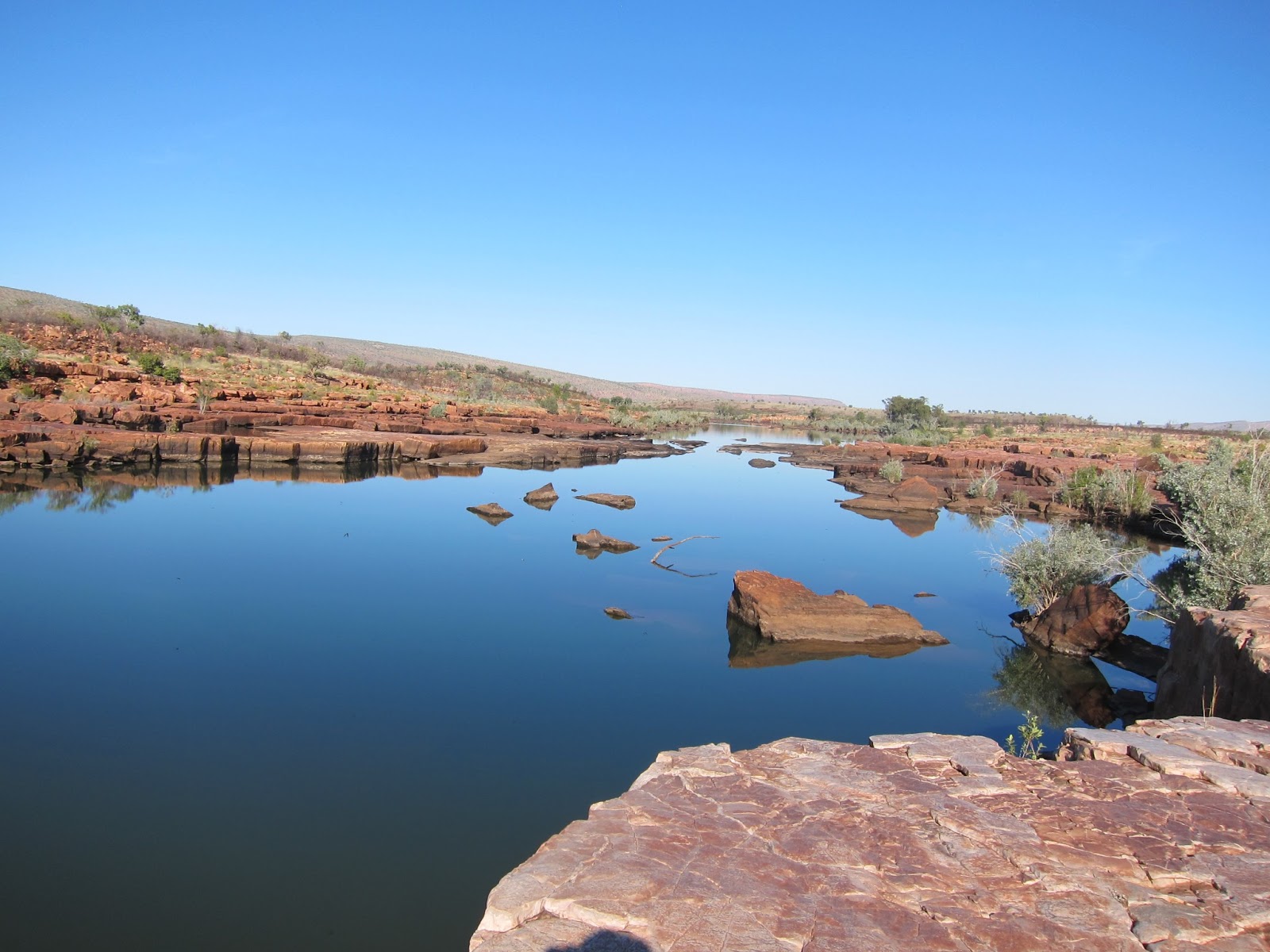
Mornington offered two gorges: Dimond (sic) and Sir John's. When we arrived at the ranger station, we asked the ranger which was better, since we had limited time. His answer was "well, they're different." We thought that was just lack of evaluative courage on his part... until we saw them ourselves.
Here's Dimond Gorge:

This is the river leading into Dimond Gorge:

The hills around Dimond Gorge:

And a "swimming hole" further up the river that was our last stop for the day:

Wow.
The next morning, we headed to Sir John's Gorge. The birds were out in force. Here are two black cockatoos:

And... the gorge itself:
White parrots flying by:
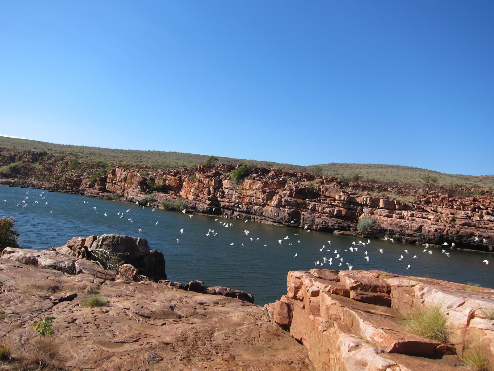
Looking up the gorge, with another flock passing by (there were several flocks - both black and white - that went by not-very-quietly while we were there):

Just to round things off, a short-eared rock wallaby made an appearance:

On our way out of Mornington, we saw this otherworldly boab:

The End of the Road: Imintji to Tunnel Creek
After making it back to the Gibb, we stopped to re-fuel. It's not a place where one can shop around for the lowest price. Diesel was 229.5 cents per liter. For our American readers: that's about $8.70 per gallon.

For lunch that day, we made a quick stop at Lennard Gorge. The sides are too steep to allow a path down, but (leaning a bit dangerously over the fence) one could get a fair sense of it:

On the map, we'd seen an unexplained point of interest called "Queen Victoria's Head." We had no idea what that was, until we saw (look to the right):

That night, we stayed at Windjana Gorge, which cuts through a nearly-vertical limestone formation. This is outside the gorge at sunset:

Inside the gorge (the next morning) felt almost prehistoric:

And, it turns out, Windjana is a great freshwater crocodile-viewing spot. We saw about a dozen. Here's one (and maybe another one in the distance):

Just down the road was a trek called 'Tunnel Creek,' where a creek has cut through another wall of limestone. The walk required flashlights and getting one's feet wet. Halfway through was a place where the top had caved in:

Someone else walking said that she'd seen a croc swimming through. So we hereby claim that we've waded through crocodile-infested waters.
Next time: Middle Lagoon and Broome.