Saturday, September 7, 2013

The Final Post: Leaving Melbourne, Driving Across the US

Well, this is it. Our last "On the Flip Side" post. Except for one box of books (which is probably on a boat now), all of our stuff has made it to Seattle, where we're starting to settle in. The whole moving experience made us feel incredibly lucky - lucky to have spent 2 years in Melbourne, lucky to know so many fantastic people (on both sides of the Pacific), and lucky to have landed in another beautiful city by the water.

In case you ever need to move from Melbourne to Seattle, we broke the process down into 6 easy steps:

Step 1: Crossing the Pacific

Cleaning out our apartment in St Kilda took some doing, but (with plenty of help!) we managed to find good homes for our furniture and housewares, and clean the place up. Here's Naomi eating a final meal on our last day there:

Our flight back went Melbourne -> Sydney (~1.5 hours), Sydney -> Dallas (~15 hours), and Dallas -> National Airport in DC (~... we stopped counting). Our connections were pretty tight, but we and our luggage made it, and stumbled through security at DC into the arms of Naomi's parents. On the way out of the airport, Naomi captured the mood:

Step 2: Drive from DC to New Mexico

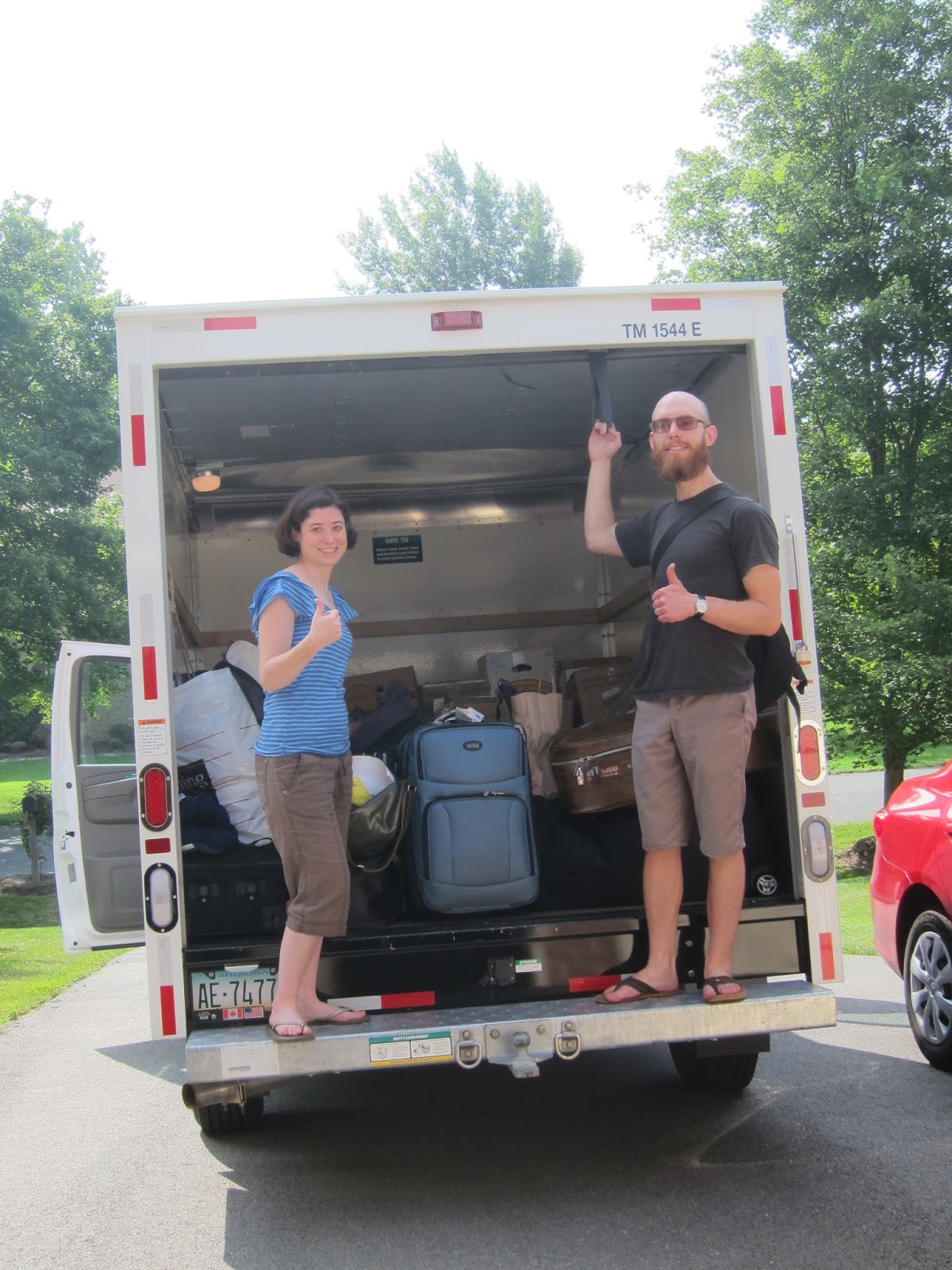
We gave ourselves a week to re-adjust to (a) the time-change, (b) the season-change, (c) the side-of-the-road-change. After a couple days up in New York, we returned to Maryland to start packing everything up. The vast majority of our belongings had been sitting in the Spector family basement for the past couple years. We stuffed it all into a 10' U-Haul. Here we are, ready to roll:

Since we didn't know when the next time would be that we'd drive across the US, we decided to make some stops to see family and friends. That ended up taking our route south, through the Caronlinas, down to Atlanta, and over to New Mexico.

Our route to Atlanta took us through the eastern tip of Tennessee, where there were clear signs about which part of the world we were in:

Colin's mad scientist brother Peter (not really mad) put us up for a night in Atlanta. He also took us for a walk in his neighborhood...

...and to a first-rate breakfast place called The Flying Biscuit:

Our next stop was in Birmingham, Alabama, where our friends Josh and Stephanie (who also just moved back to the US from Melbourne) just arrived. Yet again, we were treated to a free tour. Here's the four of us on top of the ridge overlooking the city:

After 'Bama, our goal was to get to New Mexico as quickly as possible. That night, we stayed near the Mississippi border. Colin was impressed by one of the local driver's parking:

The next morning, we crossed the Mississippi River:

We made it to Oklahoma by early evening, where massive clouds were filling the skies. The area had been having a significant amount of rain (though there were no tornadoes as we went through).

After a night at a Super 8 in Elk City, Oklahoma (you wouldn't believe what the Holiday Inn Express was charging!), we continued west. Our goal was to cross the Texas Panhandle, and arrive at Colin's dad's place near Albuquerque by mid-afternoon.

Texas was looking green (botanically speaking):

Step 3: Enjoy the Southwest

New Mexico might be one of the poorest states in the US, but it has its charm:

Our first meal was at a historic diner. We went straight for the chile-sauce boat plates. Fantastic....

It took a few hours to cross eastern New Mexico, but soon we were in the sort of landscape that Colin grew up in:

Colin's dad Bob gave us a fantastic welcome. He's working on a long-term construction project, and after days of sitting in a truck, we were eager to get some physical activity. Here's Naomi and Bob hauling some dirt for adobe floors:

New Mexico doesn't mess around when it comes to sunsets or sunrises. Here's a sunrise, as seen from Bob's cabin:

After our (too short!) stay in New Mexico, we headed northwest. Even though we were eager to make it to Seattle, we decided to take a bit of time to see southern Utah. Our route took us through the southwestern corner of Colorado:

When we were in Atlanta, Peter helped us find a reasonably-priced motel in Moab, Utah. As we got close to Moab, the rocks started getting weird:

We took a detour down along the Colorado River near sunset:

And a quick walk:

After a good dinner at the Moab Brewery and a solid sleep, we drove up to Arches National Park. Our plan was to spend half a day there, and then spend the night somewhere north of Salt Lake City.

Arches was great. Colin got to wear his favorite hat...

Naomi found a friend...

and the arches themselves were pretty amazing:


Step 4: Drive from Southern Utah to Eugene, Oregon

We spent that night in Brigham City. Here's an LDS church near where we stayed, with some pretty sunset clouds forming. Salt Lake City itself was covered in a cloud of haze... partly, we learned, due to some wildfires burning nearby.

Our next day was pretty dull. Most of it was occupied with southern Idaho. Much of that looked like this:

Or this:
...except that, if you look closely at that last picture, you can see some of the wagon ruts from the Oregon Trail. That shook us out of our mindset for a moment - the toughest thing we've had to do is drive an air-conditioned truck on nicely-paved roads.

Another reminder of the Oregon Trail appeared, appropriately enough, as we entered Oregon.

Eastern Oregon is mostly sagebrush. It's pretty, in its way, and had hints of the mountains to come:

We eventually got to the mountains, and drove through Willamette National Forest. We stopped at the top of a pass that was covered by a lava flow. Here's Naomi holding a rock:

Then we zipped down the other side of the mountain. Suddenly, things were green again:

Step 5: Family in Oregon!

We spent the next two nights with Colin's mom, Mary, who just moved up to Eugene in May:

Eugene is also home to Colin's aunt Merrilee, uncle Bob, cousins Brooke and Ryoko... and the latest addition to the family, Kahdo. Here's Bob and Kahdo:

Step 6: Washington, at last

From Eugene, the drive to Seattle was about 5.5 hours. At this stage, that felt like nothing. We felt like this sign was personally addressing us:

We came into Seattle (perhaps foolishly) via I-5. Traffic wasn't too bad, but it did give us a chance to take in the skyline:

Colin's sister Liz lives in Seattle. Not only did she make us feel instantly welcome, lend us a car, give us a place to stay, and feed us, but she also took us around the city and on some field trips. One trip was out to the mountains on the Olympic Peninsula. Here's Liz with Naomi on top of one mountain:

And here's one of the locals, an Olympic Marmot:

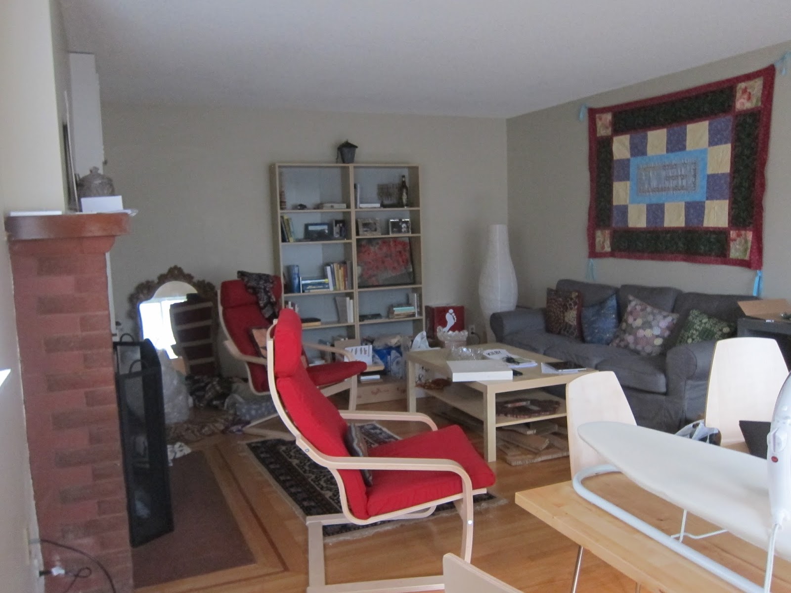
We stayed with Liz for about 10 days, and have now moved into an apartment in the Fremont neighborhood. So far, we're loving it. Here's our living room, which only has a few boxes and scraps of cardboard left:

Seattle is treating us very well so far. We hope that friends from Melbourne and elsewhere will consider coming to visit! We promise we'll have the living room cleaned up by the time you get here.


And, that's the end of our Australian adventure. Thanks for following along with us!

Wednesday, July 24, 2013

Red Rocks and Crocs: Part 2 (The Gibb River Road!)

The centerpiece of our trip was the Gibb River Road (GRR). It is a 660km dirt (aka "unsealed") road, and was the main reason we had a 4WD vehicle. The main sights along the way are a series of "pictures-can't-do-us-justice" gorges.

Everything we read about the Gibb made it sound a bit daunting, since we'd never driven on dirt roads for this long before, and never forded crocodile-infested rivers. But we made it... far more easily than we'd expected.

Here's what we saw at the beginning of the road (although the first 25kms or so were recently paved...):

El Questro

Our first stop was within El Questro (a major tourist company that owns a massive piece of land, which happens to have some gorgeous sights).

Our first gorge was at Emma Gorge. This involved a walk along a very rocky path beside a burbling creek, surrounded by some surprisingly lush vegetation.

This was a pretty-coloured pool we arrived at just before getting to the main part of the gorge. It was too big to photograph properly, but you can at least get a sense of the pretty colours:

The next stop, also within El Questro, also felt like an oasis. This was Zebedee Springs: a group of thermal springs surrounded by the rare Livitsonia Palms (which you may recognize from the Bungle Bungles).

(Look closely in the springs, to see evidence we were really in this paradise!)

The view looking up:

Pentecost River to Ellenbrae

We continued on the road, when we came upon our first (and biggest) river crossing: the Pentecost River. We'd been warned about crocs there, so we didn't linger. Since this was the dry season, the water was pretty low... and we didn't see any crocs.

Here's a view along the road just after the Pentecost River.

This was our first encounter with non-bird wildlife. Don't worry: this is a picture we took from the car, and we had no other personal encounters with snakes for the rest of the trip:
From recent Wikipedia research, Colin is pretty sure this was a non-venomous water python. He had been hoping that it was something tremendously deadly, but alas.

Our goal for our first night was to get to one of the places along the road where we could camp: a station (i.e. a ranch) called Ellenbrae. Along the driveway into the property were some very nice hand-painted signs that kept our spirits up in the heat:

We made it in time to enjoy our scones in their beautiful gardens:

The station was originally owned and built up (including the gardens and buildings) by a pair of brothers. A plaque said both died a few years apart, one in a plane crash and the other in a motorcycle accident. Their creative handiwork was still evident around the property, including this stone table with tractor-seat chairs:

That night we ate dinner by a fire. The fire was surprisingly easy to get going - pretty much everything lying around was happy to burst into flame (more about that later). This finally felt like the "real" outback.

Ellenbrae to the Mornington Turn-Off

Continuing along the road the next morning, we came across a flock of gulahs headed in the same direction:

Our mid-day goal was Barnett River Gorge. The directions we'd found online said that it was a 3k drive off the main road, and that we should allow 30 min each way for the drive. "Silly directions," we thought, "it doesn't take 30 minutes to drive 3 kilometers."

Turns out it can. The road was filled with spikey rocks just waiting for a tire to puncture. This picture only gives a vague idea...

The gorge itself was very pretty. It wouldn't have been worth a punctured tire... but our tires held up. Here's the gorge.
As you might have realized by now, 'gorge' was used pretty liberally in these parts.

Our destination for that night was a campground by the Mt. Barnett Roadhouse, by Manning Gorge. Our camping spot was next to some clusters of boabs:

The next morning, we walked to Manning Gorge. The trail wasn't long, but required one to pull oneself across by hand. Here's Colin, after our crossing, feeling proud of himself for not having dumped us in the water:

Manning Gorge itself was stunning and, like all the gorges, defied any attempts to capture it by photos. Here's one of the photos it defied (see the waterfall in the distance?):

On the road after Manning Gorge, we drove by some surprisingly large birds co-habitating peacefully with the very large cows:
We're pretty sure these were brolgas, a type of crane.

Mornington Wildlife Sanctuary

Our destination for that night was the Mornington Wildlife Sanctuary, which lies 90k off the Gibb. The Sanctuary is funded by the Australian Wildlife Conservancy. Being a considerate group, they set up a booth at the turn-off where one can radio ahead. This avoids one driving an extra 90k only to find that there are no campsites left. We were lucky - we snagged one of the last two spots. Here's the call-box:

Mornington offered two gorges: Dimond (sic) and Sir John's. When we arrived at the ranger station, we asked the ranger which was better, since we had limited time. His answer was "well, they're different." We thought that was just lack of evaluative courage on his part... until we saw them ourselves.

Here's Dimond Gorge:

This is the river leading into Dimond Gorge:

The hills around Dimond Gorge:

And a "swimming hole" further up the river that was our last stop for the day:

Wow.

The next morning, we headed to Sir John's Gorge. The birds were out in force. Here are two black cockatoos:

And... the gorge itself:

White parrots flying by:

Looking up the gorge, with another flock passing by (there were several flocks - both black and white - that went by not-very-quietly while we were there):

Just to round things off, a short-eared rock wallaby made an appearance:
This is one of the most viciously, ruthlessly cute species of wallabies. There's a good picture on the relevant Wikipedia page. Other than the wildlife, we were the only people at the gorge the whole time we were there.

On our way out of Mornington, we saw this otherworldly boab:

The End of the Road: Imintji to Tunnel Creek

After making it back to the Gibb, we stopped to re-fuel. It's not a place where one can shop around for the lowest price. Diesel was 229.5 cents per liter. For our American readers: that's about $8.70 per gallon.

For lunch that day, we made a quick stop at Lennard Gorge. The sides are too steep to allow a path down, but (leaning a bit dangerously over the fence) one could get a fair sense of it:

On the map, we'd seen an unexplained point of interest called "Queen Victoria's Head." We had no idea what that was, until we saw (look to the right):

That night, we stayed at Windjana Gorge, which cuts through a nearly-vertical limestone formation. This is outside the gorge at sunset:

Inside the gorge (the next morning) felt almost prehistoric:

And, it turns out, Windjana is a great freshwater crocodile-viewing spot. We saw about a dozen. Here's one (and maybe another one in the distance):
They were small-ish, and kind of charming.

Just down the road was a trek called 'Tunnel Creek,' where a creek has cut through another wall of limestone. The walk required flashlights and getting one's feet wet. Halfway through was a place where the top had caved in:

Someone else walking said that she'd seen a croc swimming through. So we hereby claim that we've waded through crocodile-infested waters.

Next time: Middle Lagoon and Broome.