When we move to Seattle, we'll have a bit more water in our lives. Part of what makes New Zealand's mountains so incredible is how they're set next to the ocean, lakes, waterfalls, rivers, glaciers, and fiords.
Here are some of our favorite water-related scenes (minus beach-y scenes, which we'll have in the next post).
Lake Matheson
Near the town of Fox Glacier, where we stayed for our second night, is a lake that is known for how it reflects the mountains. We were told to get there early, before the clouds moved in.
Our luck was fantastic:
The lake was almost a perfect mirror... with some lingering mist for extra effect.
That tall thing is Aoraki/Mt. Cook, the highest mountain in New Zealand. Later, we'll see it from the other side. But this view (which they named "the view of views") was unbelievable... even worth sharing the path with a bus-load of British teenagers.
Glaciers
The snow you see on those mountains feeds into glaciers. There are two glaciers that are especially easy to visit: Franz Josef Glacier and Fox Glacier.
We came to Franz Josef first. The valley felt like something from some other era - not for the last time, it felt like the laws of physics had been changed just a bit:
For safety reasons, we couldn't get too close, but the walk up the valley was stunning. A stone-grey stream came out from under the glacier:
Our weather luck was better with Fox Glacier, and the safe path allowed us to get much closer. A huge river of ice, with ice-valleys instead of waves:
As the glacier moves along, rocks and dirt fall on top of it (since it's carving out the valley). Here you can see part of the edge, along with some helpful signs about why one shouldn't run up to touch it:
This was the view back down the valley. You can see how, when the glacier went further, it carved almost vertical cliffs:
Waterfalls
The waterfalls we saw tended to be dwarfed by other parts of the scene, but were still striking. (Despite being less dramatic than at other times of the year, since it had been a particularly dry summer). Here's one in the Franz Josef valley:
The next is, according to our guidebook, one of the most photographed waterfalls in the world (whatever that means). We hereby add one more:
The closest we got to a waterfall was this one:
This waterfall goes directly into Milford Sound. This view was from a boat. Speaking of which...
Milford Sound
Milford Sound may be the main tourist destination on the South Island. Turns out there is good reason for that. One approaches by road (see our previous posts), eventually ending up at the edge of the water:
The best way to see the Sound (which is actually a fjord) is by boat. We got some advice about dodging the main rush of tourists, and had a pretty comfortable ride on the red boat here:
If we'd had more time, we would have done a kayak tour, but what we saw was still pretty amazing.
Heading out towards the sea, here's a more distant view of the waterfall from above:
The waterfall is at the point where two glaciers once met.Another view on the way out:
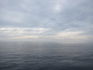
At the mouth of the fiord is the Tasman Sea (if you kept going in this direction, you'd get to Australia):
We then turned around and headed back inland:
We could have also done a scenic plane ride. We opted out of that, but Naomi caught this shot:
Lakes
The mountain range forms a pretty effective rain barrier. Not far from the above, one suddenly finds dry mountains and stunningly blue skies:
This is near Queenstown (more on that later).
Later in our trip, we headed back towards Aoraki/Mt. Cook from the east. Here you can see it across Lake Punakaki:
The water really is that color. We read that it's due to some sediment that reflects light in a certain way. Our last night was spent next to the lake just near it, Lake Tekapo (which had a similar sediment-light effect). Here are some other visitors we saw:
And one more shot, bringing out the bizarre color:
Next time: Animals, beaches, and forest (and sun)!


No comments:
Post a Comment